After year off because of a fire in the church, the Greek Festival returned to St. Demetrios Greek Orthodoc Church on Fort Lowell Avenue. Over the course of three days there were dances, church tours and lectures by U of A professors on various Greek topics. Visitors could enjoy all types of Greek food from Gyros and Spanikopita to Baklava and Greek wines as well. Tara ate a Gyro while I ate Chicken Souvlaki both of which were very good. Quintin enjoyed the dancing and food but was tired by 8 pm. After Tara and Quintin left I toured the Church. It is sad to see that construction has come to a halt because of a lack of funds.
Monday, October 13, 2014
Greek Festival Tucson, Arizona September 27, 2014
Dancers
After year off because of a fire in the church, the Greek Festival returned to St. Demetrios Greek Orthodoc Church on Fort Lowell Avenue. Over the course of three days there were dances, church tours and lectures by U of A professors on various Greek topics. Visitors could enjoy all types of Greek food from Gyros and Spanikopita to Baklava and Greek wines as well. Tara ate a Gyro while I ate Chicken Souvlaki both of which were very good. Quintin enjoyed the dancing and food but was tired by 8 pm. After Tara and Quintin left I toured the Church. It is sad to see that construction has come to a halt because of a lack of funds.
Quintin enjoying the festivities
Big tents
After year off because of a fire in the church, the Greek Festival returned to St. Demetrios Greek Orthodoc Church on Fort Lowell Avenue. Over the course of three days there were dances, church tours and lectures by U of A professors on various Greek topics. Visitors could enjoy all types of Greek food from Gyros and Spanikopita to Baklava and Greek wines as well. Tara ate a Gyro while I ate Chicken Souvlaki both of which were very good. Quintin enjoyed the dancing and food but was tired by 8 pm. After Tara and Quintin left I toured the Church. It is sad to see that construction has come to a halt because of a lack of funds.
Sabino Canyon Seven Falls, Catalina Mountains September, 27, 2014
Location: Sabino Canyon is the trail head for Seven Falls. To get to Sabino Canyon from the University of Arizona take Campbell Avenue north toward the Catalina Mountains. Turn right onto Skyline Road. Skyline will become Sunrise Road. Keep driving until you reach Sabino Canyon Road. Turn left and you will see the parking lot on the right.
A year and a half ago I hiked the 7.6 miles to Seven Falls by way of Bear Canyon. I remember the hike was very pretty but I also remember it as being very popular with tourists. If you come to Tucson or live in Tucson this is the hike everybody chooses to do. As a result, of this popularity rescues in Bear Canyon are common. In fact today I saw a woman who injured her knee when she jumped from a high rock into one of the deeper pools. I also saw a number of couples who were carrying very little water. The trail is easy to follow and few route finding skills are needed. There are four creek crossings that could pose challenges during the monsoon season. There are also a few areas where people have created illegal trails by cutting switchbacks. Please stay on the trail. These illegal trails cause erosion and they also can get you in steep rocky terrain. On this hike I did see 50 or more Army personnel (from Marana) who were hiking this trail to stay fit. They were very friendly and even helped out the woman who injured her knee.
Tuesday, October 7, 2014
Goodenough Mine Tour Tombstone, Arizona September 20, 2014
Directions: Once in Tombstone, Arizona, the mine is located on the intersection of Toughnut and Fifth Street. Tours occur on the hour starting at 10 am and ending at 4 pm.
History: In 1877 Ed Schieffelin discovered silver-ore in 1877 in southern Arizona. He named the new claim tombstone to poke fun at the Arizonans who claimed he would find nothing but his tombstone in southern Arizona. A year later he returned and filed the claim for the Good Enough Mine. The boom was on and thousands of prospectors came to Tombstone to strike it rich. Mining waned in 1890 due to a decline in silver prices as well as flooding in the mines. The mines produced about $85 million in silver.(Information from www.roadsideamerica.com).
The Tour: The tour is approximately 45 minutes to an hour. Visitors have to wear a white hard hat and vest before entering the mine. The most physically demanding part of the tour were the three flights of stairs at the beginning. The most interesting part of the tour for me was seeing an example of a silver ore vein and observing the cavernous tunnels of the mine. I also found it interesting how much garbage volunteers hauled out of the mine in 2007 before they opened for tourists. Our tour guide could have offered more historical facts about the mine as well as Tombstone, Arizona. For visitors who are interested they offer a three hour and six hour tour
Friday, September 19, 2014
King Canyon to Wasson Peak Saguaro National Park West September 13, 2014
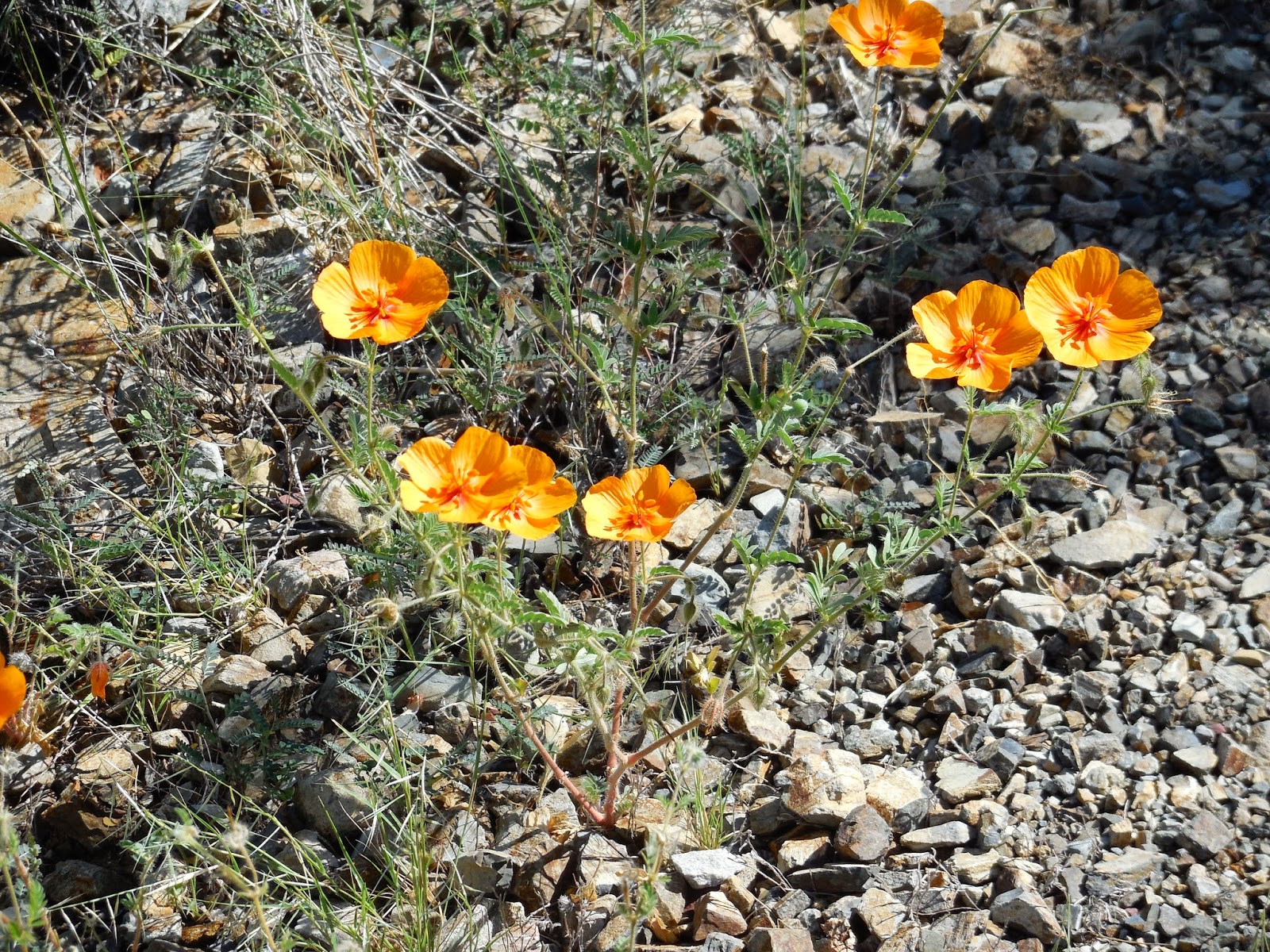
Arizona poppy
Directions: King Canyon is located near the Arizona Sonoran Desert Museum. To get to the trail head take Speedway west from the University of Arizona. Drive under I-15 and follow the directions to Gates Pass. From Gates Pass carefully drive the windy road to Kinney Road. Turn right and watch for the trail head on the right near the museum.
The Hike: I returned to Saguaro National Park West to complete all four trails to the top of Wasson Peak. Trails included in this group are Sendero Esperanza, Hugh Norris, King Canyon and Sweetwater. All of these routes are beautiful but my personal favorite is Hugh Norris because it is longer and has views the whole way to the top.
Last Saturday we finally had temperatures cool enough (low 90s) to hike in the lower elevations so I took advantage. When I exited the car at 9 am there were clouds in the air and a cool wind blowing. I made good time hiking the old road that leads to the Mam-a-Gah Picnic Area. For visitors who do not want to hike the old road a lower trail follows the wash below. The Mam-a-Gah Picnic Area was built by the Civilian Conservation Corps in the 1930s. Today the buildings are crumbling under disrepair. The flora of this part of the trail is Saguaro, Palo verde, Ocotillo, and different species of cholla. After following the wash a short distance, the King Canyon trail becomes steep. Views start to open up toward Kitt Peak and the Baboquivari Hills to the west. The trail continues to climb until it reaches a saddle where the Sweetwater Trail descends east toward town. Follow the Hugh Norris northward as it switchbacks its way past a number of inactive mines. After 1.1 miles a spur trail to the summit departs to the right. Wasson Peak is one of my favorite peaks to climb near Tucson because it offers a fantastic view. From the summit it is possible to see 20 wilderness areas.Total mileage was 7 miles with about 2000 feet of elevation gain.
Lizard
Wild- dwarf morning glory
Trailing windmills
Lilly
View looking east from top
Ocotillo with leaves
Trail near top
Arizona poppy
Directions: King Canyon is located near the Arizona Sonoran Desert Museum. To get to the trail head take Speedway west from the University of Arizona. Drive under I-15 and follow the directions to Gates Pass. From Gates Pass carefully drive the windy road to Kinney Road. Turn right and watch for the trail head on the right near the museum.
The Hike: I returned to Saguaro National Park West to complete all four trails to the top of Wasson Peak. Trails included in this group are Sendero Esperanza, Hugh Norris, King Canyon and Sweetwater. All of these routes are beautiful but my personal favorite is Hugh Norris because it is longer and has views the whole way to the top.
Last Saturday we finally had temperatures cool enough (low 90s) to hike in the lower elevations so I took advantage. When I exited the car at 9 am there were clouds in the air and a cool wind blowing. I made good time hiking the old road that leads to the Mam-a-Gah Picnic Area. For visitors who do not want to hike the old road a lower trail follows the wash below. The Mam-a-Gah Picnic Area was built by the Civilian Conservation Corps in the 1930s. Today the buildings are crumbling under disrepair. The flora of this part of the trail is Saguaro, Palo verde, Ocotillo, and different species of cholla. After following the wash a short distance, the King Canyon trail becomes steep. Views start to open up toward Kitt Peak and the Baboquivari Hills to the west. The trail continues to climb until it reaches a saddle where the Sweetwater Trail descends east toward town. Follow the Hugh Norris northward as it switchbacks its way past a number of inactive mines. After 1.1 miles a spur trail to the summit departs to the right. Wasson Peak is one of my favorite peaks to climb near Tucson because it offers a fantastic view. From the summit it is possible to see 20 wilderness areas.Total mileage was 7 miles with about 2000 feet of elevation gain.
Thursday, September 18, 2014
Butterfly Trail Mount Lemmon August 30, 2014
Directions: The Butterfly trail is located off of the Catalina Highway near Tucson, Arizona. Don't start looking for the trail head until you have driven over 20 miles. Along the way are a number of beautiful pull-offs including Windy Point Vista and San Pedro Vista. Remember a visitor pass ($5 for a day and $20 for the year) is required to park at picnic areas and trail heads in the Coronado National Forest. For this hike I did not start the Mount Bigelow trail head but the one above it near the Palisade Ranger Station.
The Hike: The trail starts off in the shade with towering Ponderosa pines and Douglas fir. After ascending over a small ridge the trail enters a landscape that is recovering from a fire in 2003. This part of the hike is not shaded and can get hot in the afternoon make sure to wear a hat and sunblock. In this area the Crystal Spring trail departs at a well-signed junction. After three miles the trail reaches a ravine with a creek that flows during the monsoon period. An unmarked trail takes visitors to a waterfall and beautiful lunch spot. At a point where the trail ascended precipitously to Mt Bigelow Nathan and I turned around. Throughout the trip I saw a profusion of columbine in the creek beds as well as Daisies and Corral bells along the trail. Views were predominantly of the San Pedro Valley and distant Mount Graham. Total Mileage was about 7.4 miles with 1500 feet of elevation gain.
Monday, September 1, 2014
Night Wings Pima Air and Space Museum August 23, 2014
On August 23rd I returned to Pima Air and Space with the family for the third and final installment of night wings. Night Wings gives visitors the chance to visit the museum when it is cooler and engage in some activities as well. On this particular visit Pima County Search and Rescue gave a demonstration.
Palisade Trail August 23, 2014
Beautiful multi-colored mushroom on the trail
Location: Take the Catalina Highway 19 miles to the Organization Control Road right before the Palisade Ranger Station.The trailhead is 3/4 of a mile on the right.
The Hike: The Palisade Trail, nine miles, starts in the pine forest of Mount Lemmon and ends at Sabino Canyon. It gives hikers the opportunity to see the main vegetation types of southern Arizona including pine forests, oak woodlands, grasslands with Ocotillo and finally Saguaro cacti. This trail looses about 3800 feet of elevation so it is steep in places. Some route finding skills might be necessary on this route. Please inquire with rangers about trail conditions near the East Fork of Sabino Canyon.
Trail Description: The first four miles I was on the trail is well-worn and easy to follow. After leaving the trail head it follows the upper part of Palisade Canyon on Organization Ridge. Here there are a few trails that descend to the creek below and its beautiful pools. At 0.8 miles a side trail ascends to a Girl Scout Camp be sure to keep hiking straight. In this section of the trail I saw a number of different species of mushroom. After a mile the trail descends into Pine Canyon. Here it appeared the forest burned so this was definitely the hottest section of the hike. After about 2.3 miles the trail reaches Mud Spring which is not a reliable source of drinking water.After crossing the creek the trail ascends to the western side of the canyon. In this section look for a beautiful waterfall in Pine Canyon. After 3.5 miles the trail reaches a bluff with a beautiful view of the East and West Fork of Sabino Canyon as well as Tucson, Arizona, and the Rincon Mountains. From here it appeared that the trail descended rapidly to the East Fork so I chose this bluff as a nice spot to turn around. Total mileage for the day was about eight miles (plus a short excursion to a nice lunch spot). Some information from Hiking Arizona's Cactus Country by Erik Molvar)
Pine forest on the upper section of the hike
Snag
Wild-dwarf morning glory
Great lunch spot
Looking into the Catalina Mountains
East from the turnaround bluff
Location: Take the Catalina Highway 19 miles to the Organization Control Road right before the Palisade Ranger Station.The trailhead is 3/4 of a mile on the right.
The Hike: The Palisade Trail, nine miles, starts in the pine forest of Mount Lemmon and ends at Sabino Canyon. It gives hikers the opportunity to see the main vegetation types of southern Arizona including pine forests, oak woodlands, grasslands with Ocotillo and finally Saguaro cacti. This trail looses about 3800 feet of elevation so it is steep in places. Some route finding skills might be necessary on this route. Please inquire with rangers about trail conditions near the East Fork of Sabino Canyon.
Trail Description: The first four miles I was on the trail is well-worn and easy to follow. After leaving the trail head it follows the upper part of Palisade Canyon on Organization Ridge. Here there are a few trails that descend to the creek below and its beautiful pools. At 0.8 miles a side trail ascends to a Girl Scout Camp be sure to keep hiking straight. In this section of the trail I saw a number of different species of mushroom. After a mile the trail descends into Pine Canyon. Here it appeared the forest burned so this was definitely the hottest section of the hike. After about 2.3 miles the trail reaches Mud Spring which is not a reliable source of drinking water.After crossing the creek the trail ascends to the western side of the canyon. In this section look for a beautiful waterfall in Pine Canyon. After 3.5 miles the trail reaches a bluff with a beautiful view of the East and West Fork of Sabino Canyon as well as Tucson, Arizona, and the Rincon Mountains. From here it appeared that the trail descended rapidly to the East Fork so I chose this bluff as a nice spot to turn around. Total mileage for the day was about eight miles (plus a short excursion to a nice lunch spot). Some information from Hiking Arizona's Cactus Country by Erik Molvar)
Subscribe to:
Posts (Atom)