Trail profile from www.tucsonhikes.wordpress.com
Location: The trail head for Pontatoc Ridge is located at the end of North Alvernon Road. Take Campbell Road to Skyline Road. Take a right onto Skyline Road and drive until you see Alvernon Road on the left. Three trails originate at this trail head including Finger Rock Canyon, Pontatoc Canyon and Pontatoc Ridge. The Finger Rock Canyon trail is longer giving hikers and backpackers the chance to connect into more trails in the Catalina Mountains. Finger Rock is also popular with hikers who want to climb Mount Kimball.
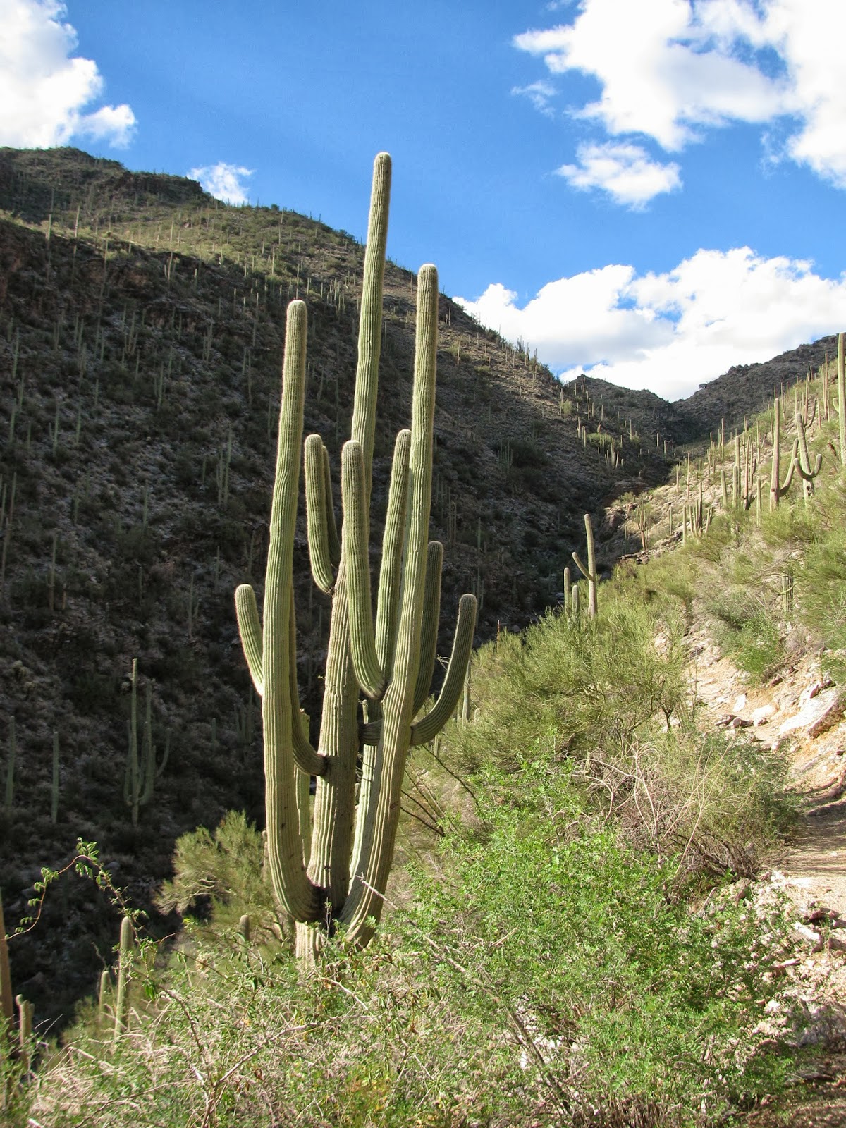
Hike and Trail Description: Today I started hiking around three o'clock to take advantage of the late afternoon and early evening temperatures. I chose Pontatoc Ridge because it was shorter and it gained elevation quickly. The hike is about 5 miles round trip and it gains over 2000 feet in elevation. The Pontatoc Ridge trail branches off from Pontatoc Canyon after one mile of hiking. The trail sweeps back to the front of the ridge and then gains elevation quickly. The trail is very rocky so watch your footing and the cacti which grow over the trail in places. The trail gets faint and hikers have made other illegal trails making it hard to follow. If you hike in the Catalina foothills watch out for rattlesnakes. Today I saw a beautiful Mohave rattlesnake. The snake was not at aggressive and actually more afraid of me. I gave it plenty of room and watched from a distance. Snakes play a vital role in our ecosystem so don't kill them.
A forest of Teddy Bear Cholla
Finger Rock Canyon in the background with Yucca and Ocotillos in foreground
Looking up Pontatoc Canyon
Saguaros with Tucson in the valley
Forest of Teddy Bear Cholla; I wouldn't hug them though.
Mohave Rattlesnake; distinguishable by green tint.
Late afternoon sun.
Last light on Pontatoc Ridge
Catalina foothills
Tuesday, October 1, 2013
Friday, September 27, 2013
AMARG "The Boneyard" Tour Davis-Monthan Airforce Base September 25, 2013
Reconnaissance Plane with radar dome on top
General Information: The tour of "The Boneyard" is given by the Pima Air and Space Museum twice a day from Monday through Friday. The tour is $7 more than the regular admission price. Because it is on a military airbase camera cases and purses are not allowed. Each person needs to have a valid ID to get onto Davis- Monthan. I would highly suggest this tour because the Docents are very knowledgeable about the history of each plane and AMARG.
History: After World War II the Army's San Antonio Air Technical Service Command established the storage facility to store B-29 and C-47 aircraft decommissioned after the war. Davis-Monthan was chosen because of Arizona's arid climate and hard compact soil. Today "The Boneyard" is managed under the 309th Aerospace Maintenance and Regeneration Group. AMARG oversees the storage of 4,400 aircraft from the Air Force, Navy, Army, Coast Guard and NASA. The grounds are divided into two sections one stores planes which are used for parts and another stores planes that could become operational in the future. (Information from www.dm.af.mil/units/amarc.asp).
B-29s; they were equipped to carry nuclear weapons.
Military Helicopters with covering over windows to keep the elements and wildlife out
Fighters lined up
A transport in the parts section with its tail missing.
Fighters which will never fly again used for parts
KC-130 Tankers on the left
Fighter jets with the mountains in the back.
Tumamoc Hill Tucson, Arizona September 24, 2013
Catalina Mountains with Tucson in the foreground
Location and hours: To get to Tumamoc Hill take Speedway underneath Interstate 10 until you reach Silverbell Road. Turn onto Silverbell and drive until Anklam Road. Follow Anklam Road behind Saint Mary's Hospital. You will see the trail (small road) on your right. Tumamoc Hill is a research facility for the University of Arizona so the area is closed from 7:30 am to 5:30 pm M-Friday. Parking can become an issue so come early.
The hike: The hike is three miles roundtrip with 1000 feet of vertical. The trail is a small fire road so route finding is not difficult. The view from the top is incredible with downtown Tucson, the Catalina Mountains, Rincon Mountains and Tucson Mountains all viewable. This hike is very popular so do not expect solitude. In fact I was constantly with other people the whole time. Despite the crowds I am going to come back many times to watch the sunrise and sunset. Special Consideration: Stay on the road. Remember this is a research area so access is not guaranteed in the future.
West from the trail
Looking south from top. Photo framed with Ocotillos.
Tuesday, September 24, 2013
Esperero Trail Sabino Canyon, Arizona September 22, 2013
The foothills of the Catalina Mountains
On Sunday I returned to Sabino Canyon earlier in the day to hike on the Esperero Canyon Trail. Even though the temperature was cooler at 95 degrees I still had to bring four liters of water. (I suggest carrying allot of water even on short hikes in the desert. In the dry air and heat it is easy to become dehydrated). This trail is easy to follow yet very rocky in places. Overall I hiked over six miles and will definitely be back.
The Esperero Trail follows the main trail from the Visitor's Center and then within 0.2 miles branches of to the left ascending toward Upper Sabino Canyon Road. After one mile the trail enters the Push Wilderness and follows the foothills of the Catalina Mountains climbing in and out of Bird and Rattlesnake Canyons. This trail is easy to follow and beautiful. The views south and north are beautiful. The trail also has in my opinion one of the best displays of Sonoran vegetation near Tucson. There are dozens of picturesque Saguaro Cacti and Cholla Cacti. Other vegetation include Palo Verde and Prickly Pear Cacti. It is possible to connect into the whole trail system of the Catalina Mountains by hiking this trail. In the future I want to hike up Esperero Canyon and connect into Ventana Canyon. Special warning: Watch out for Mountain Lions around rock outcrops. If you see one back away, throw rocks and make yourself look big and formidable. Do not run. For in depth information on the location of Sabino Canyon in Tucson, Arizona, please consult my April 13, 2013 post on Bear Canyon.
Saguaro Cacti and sky
Dead Saguaro Cactus decomposing
Teddy Bear Cholla
A very picturesque Saguaro in Esperero Canyon
The beauty of Sabino Canyon late in the day
Thursday, September 19, 2013
Afternoon and Evening hike on Phoneline Trail Sabino Canyon, Arizona September 16, 2013
Desert vegetation including Saguaro Cactus, Teddy bear Cholla, Ocotillo
On September 16th I arrived at Sabino Canyon earlier in the afternoon to hike more of the Phoneline Trail and see the sunset higher up. I left the visitor's center at 4 pm and hiked on the trail toward Bear Canyon. After 0.8 miles I crossed Sabino Creek which had a healthy flow. The desert was also greener a direct result of the healthy monsoon season in southern Arizona. The Ocotillos have robust foliage on them. I hiked on the Phoneline Trail for 2.5 miles until I turned around because of darkness. Overall I hiked about six miles. Enjoy my pictures of the beautiful sunset and evening.
On the Phoneline Trail looking toward Tucson
Looking up Sabino Canyon with last light. Pusch Wilderness is on your right and ahead.
Ocotillo, rocks and setting sun colors
Arizona sunset
Vegetation with sunset colors
Evening hike at Sabino Canyon, Arizona September 14, 2013
Sonoran Desert vegetation with the Catalina Mountains in the background
Of all the hiking opportunities in Tucson, Arizona, Sabino Canyon in the foothills of the Catalina Mountains is one of the best. The views of the Tucson Mountains to the south and the Rincon Mountains to the west are extraordinary. Picturesque Saguaro Cacti and Cholla Cacti are also prevalent. At least three trails radiate out from Sabino Canyon into the Pusch Wilderness. An adventurous hiker or backpacker can hike from Sabino Canyon to the top of Mount Lemmon. Because of its beauty Sabino Canyon is very popular. In fact most weekends the parking lot fills up by mid-morning. To park a visitor's pass is required: $20 for the Coronado National Forest (good for a year includes Mount Lemmon and Madera Canyon to the south) or $5 for the day.
Today I arrived at 5 pm to enjoy the desert in the evening and watch the sunset. Daytime temperatures are still around 100 so early morning or late afternoon hikes in the lower elevations is recommended. I left the visitor's center and walked to Sabino Canyon and then off-trail (I don't recommend doing this in the Sonoran Desert to the Phoneline Trail and back). Overall mileage was only 3 miles but I saw a beautiful sunset and some wildlife including a Roadrunner, Mule Deer and many different species of birds.
Ocotillos and Saguaro Cacti with the Rincon Mountains in the background
Desert sunset with Tucson Mountains
Evening in the desert
Ocotillo and sky
Ocotillos and Saguaro with last light
Wednesday, September 11, 2013
Pima Air and Space Museum Tucson, Arizona September 7, 2013
Grunman F9-8P Cougar
If you are taking a trip to Tucson, Arizona, I would suggest visiting the Pima Air and Space Museum on Valencia Road off Interstate 10. This museum is one of the largest air museums in the world with over 300 aircraft on 80 acres. Docents lead tours of the Spirit of Freedom Hangar, and Hangars 3 and 4. For $7 extra a visitor can visit the Bone yard at nearby Davis Monthan Airbase. I would suggest visiting the museum over the course of a few days because it is big and can be overwhelming if you try to see everything in one day.
Hours and Admission: The museum is open seven days a week from 9am to 5pm. Parking is free. Admission is $15.50 for adults and $12.50 for Pima County Residents, Seniors and Military. Different levels of membership are available for visitors who want to return multiple times. A tour of the Bone yard is an extra $7. (Information from www.pimaair.or)
Quintin at the controls
Huey Helicopter used in Vietnam
B-29 Bomber
P-51 Mustang
Part of the artists project
Douglas B-23 Dragon
Outside the museum
Subscribe to:
Posts (Atom)