Thursday, June 26, 2014

Summer Activities at the Arizona Sonoran Desert Museum June 21, 2014

                                   Tara and Quintin

Starting in June, every Saturday, the Arizona Desert Museum in Tucson has extended hours from 5-10 pm as well as special presentations and performances. This gives visitors an opportunity to see beautiful sunsets in the desert as well as come when the animals are more active. Last week the theme was "nocturnal animals" in the desert. A visit included a presentation given by the museum's education staff, Native American flutes, and stargazing. If you do go arrive early because this is a popular event.  Next week the theme is about Native Americans in the Sonoran Desert. For a full list of events at the Arizona Sonoran Desert Museum please visit their website.

                               An Elf owl

                      Q and the golden glow of light at dusk

                        The beauty of the desert in the evening

                            Sculpture

                                 Ocotillos and sunset

                                 Skunk during presentation

                               Grounds lit up at night
                         

Nighttime Visit to the Titan Missile Museum June 14, 2014

                                 Tara and Quintin inside the launch area

Three times during the summer the Titan Missile Museum in Sahuarita, Arizona, has Moonlight Madness. From 5-9 visitors can take a 30-minute tour of the launch area, watch a Mad scientist demonstration and sample space ice cream The Mad scientist demonstration included seltzer rockets as well as informative education about how an ICBM works.. When we arrived for our tour at 5:20 the temperature outside was still over 100 degrees, by 6 pm the temperature had declined to a more manageable 98 degrees. In the future we will attend the event later. Other Moonlight Madness dates include: July 12, August 9 and September 13. Cost is $7 for adults and free for children 12 years and under.  For a more comprehensive history of the Titan Missile program please visit my December 2013 post on the museum..

                             Tara and Q with the Titan in the background


                             Quintin on the grounds

                                 Quintin and I on the grounds

Mt, Guthrie Catalina Mountains June 16, 2014

               View east on the Green Mountain trail

Location: The upper Green Mountain trailhead is located at the San Pedro Vista point about 17 miles up the Catalina Highway on Mount Lemmon. Remember to park here for a day hike requires a recreational pass : $5 for a day and $20 for a year.

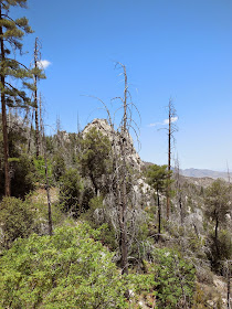
The hike: Today my friend Nathan and I are climbing Mt. Guthrie which at 7300 feet  provides great views  of the Rincon Mountains and the city of Tucson. The first part of the hike is on the Green Mountain trail. After climbing over the shoulder of Green Mountain the trail descends 600 feet down the eastern side. Here the views toward the east open up with hikers able to see the Galiluro Mountain range across the San Pedro Valley as well as Mt. Graham on the New Mexico border. This forest burned during the Aspen so there are many exposed sections to the sun. Bring plenty of water. A number of trails exit the Green Mountain trail in this section including the Brush Corral trail and Maverick trail. The Brush Corral trail is a long trail which descends into the San Pedro Valley. If you do take the Brush Corral trail make sure to bring a map and compass as well as plenty of water and food. Some of these trails become faint and are hard to follow. Route finding skills are a necessity. After two miles the Green Mountain trail reaches Bear Saddle. From here the summit of Mt. Guthrie is about 1.5 miles. It is in this area that Nathan and I saw a Coatimund.  This is the third one I have seen on this part of Mt. Lemmon.  Keep an eye out for them on the Green Mountain and Bug Springs trails.  The trail is easy to follow but there is one short section which requires scrambling across some exposed rock. Once on top I would move a little ways down the ridge to get a better view toward the north and east.

                     San Pedro Valley and the Galiluro Mountains in the distance

                         A picturesque tree

                           On the ridge of Mt. Guthrie


                        Looks like somebody took a bite out of this tree.
                     
                            Just down from the San Pedro Vista Point

Sunday, June 22, 2014

Carr Peak Huachuca Mountains May 26, 2014

                          Hiking up Carr Peak

Directions: Take State Route 92 south of Sierra Vista. Turn right onto Carr Canyon Road. After 1.2 miles the road becomes gravel. Eventually the road gains elevation quickly through some hairpin turns. I definitely wouldn't drive this road if you get vertigo or if there is a chance of rain. After seven miles turn left at the Reef Townsite Campground. The trail head is at around 7200 feet so actual elevation gain to the summit is a little over 2,000 feet.

The Hike:Round trip to Carr Peak is about six miles long. Because of this shorter length the peak is popular with locals and visitors who do not want a longer hike. The first part of the trail is on the Sawmill Trail an old road used during the Reef Townsite boom years. This trail is not very pretty, rocky and extremely hot.  At the entrance to the Miller Peak Wilderness the old road becomes a rocky trail. Here the trail  begins to gain elevation rapidly through a series of switchbacks.  It continues its ascent passing through a forest that burned in 1977. There are a few stands of Douglas fir and Gambel oak which did not burn. The trail swings around Carr Peak before cresting the summit. At the top it is possible to see many mountain ranges including the Whetstones to the north and the Chiricahuas and Dragoons to the east. I do not suggest this trail during the heat of the summer because it is very exposed to the sun. If visitors are looking for a longer hike it is possible to continue on to the Huachuca Crest Trail.

                   Miller Peak

                Looking north

                 Picture of myself on top


                          Nice shady spot for a rest,


                         Colorful lizard


Saturday, June 21, 2014

Tanque Verde Ridge Saguaro National Park East May 24, 2014

                                         Looking toward Tucson fromthe Tanque Verde Trail                  

Location : The trail for Tanque Verde Ridge is located at the Javelina Picnic Area off of Cactus Forest Scenic Drive. To get to the trail head a visitor has to get either a one-day pass ($5) or a year pass for $20.

The hike: Tanque Verde Ridge is one of the flagship hikes in Saguaro National Park.. It is possible to hike all the way to Manning Camp 15 miles from the Javelina Picnic Area. There is also a back country camp at Juniper Basin with a seasonal spring. The first half mile to mile the trail climbs to the spine of Tanque Verde Ridge From here it follows the spine of the ridge to Juniper Basin, Tanque Verde Peak and finally Manning Camp.. In the foothills of the Rincon Mountains the vegetation consists of Saguaros, prickly pear and Ocotillo. As hikers keep ascending the views open up every direction with the high peaks of the Rincon Mountains to the south and the Catalina Mountains to the north. At 5000 feet vegetation becomes more Bear grass and Lechugilla. After 3.5 to 4 miles of hiking Franak and I stopped to eat lunch at a rock outcrop with 360 degree views. This trail is beautiful but there is very little shade so if you are going to hike during the summer hike early in the morning. Total mileage was about 7-8 with 1500 feet of elevation gain. (Information from Hiking Arizona's Cactus Country by Erik Molvar.

                Beautiful view looking toward South Canyon.

               Ocotillos with Rincon Mountains in background

                     Gopher snake at our lunch spot


                            Scenery in the upper part of Saguaro National Park